The European Space Agency’s (ESA) Earth Observation for Sustainable Development Climate Resilience (EO4SD CR) cluster has released a new brochure providing an overview of its work in integrating Earth Observation (EO) services into decision making and design processes that help to enhance environmental management.
A changing climate is already leading to changes in our terrestrial, freshwater, and marine ecosystems, compounding the effects of centuries of human-induced degradation and disturbance. This is not only leading to changes in long-term declines in the number of vertebrate and non-vertebrate species, but changes in the type, structure, and composition of ecosystems.
This change is happening at scale and pace that exceeds many ecosystems’ (and species’) capacity to adapt and at the same time as their exposure to severe climate-related hazards is increasing. The result is not only the loss of biodiversity and ecosystem resilience, but increased risks to food security and water supplies owing to a decline in agricultural yields and changes in river catchments.
With the world on a path to be at least 2 degrees Celsius warmer than the pre-industrial average before the end of this century, sound decisions are necessary to transform the condition of ecosystems, and at the same time reduce risks to future generations. In part, this means taking advantage of the latest satellite data to identify at-risk ecosystems, and guide actions that reduce stressors and improve resilience.
EO data provides a number of strengths and benefits that are being used for a range of problem-solving to help build climate resilience in different contexts. Through an ongoing engagement with several International Finance Institutions (IFIs), the EO4SD CR cluster has identified real-world cases for EO data in several projects that are summarised in this brochure.
Click here to download the brochure.
This brochure highlights products developed by the EO4SD CR cluster that support:
- Assessing wildfire risk (Changde, China)
Changde, China has seen considerable urbanisation and economic development in recent decades which has greatly exacerbated the risks associated with natural disasters, including from wildfires. EO data may be used to map areas of the Changde jurisdiction which may be exposed to wildfire.
-
Planning of wetland restoration and rehabilitation (Lake Victoria and Lesotho)
The highly populated Nyabuogogo catchment and natural wetland suffers from significant degradation of land, vegetation and water resources. EO data can help continuously monitor wetlands degradation on a national coverage, as well as monitor and evaluate the impact of each type of rehabilitation intervention on the wetlands.
-
Monitoring land degradation (Lesotho, Kyrgyzstan and Tajikistan)
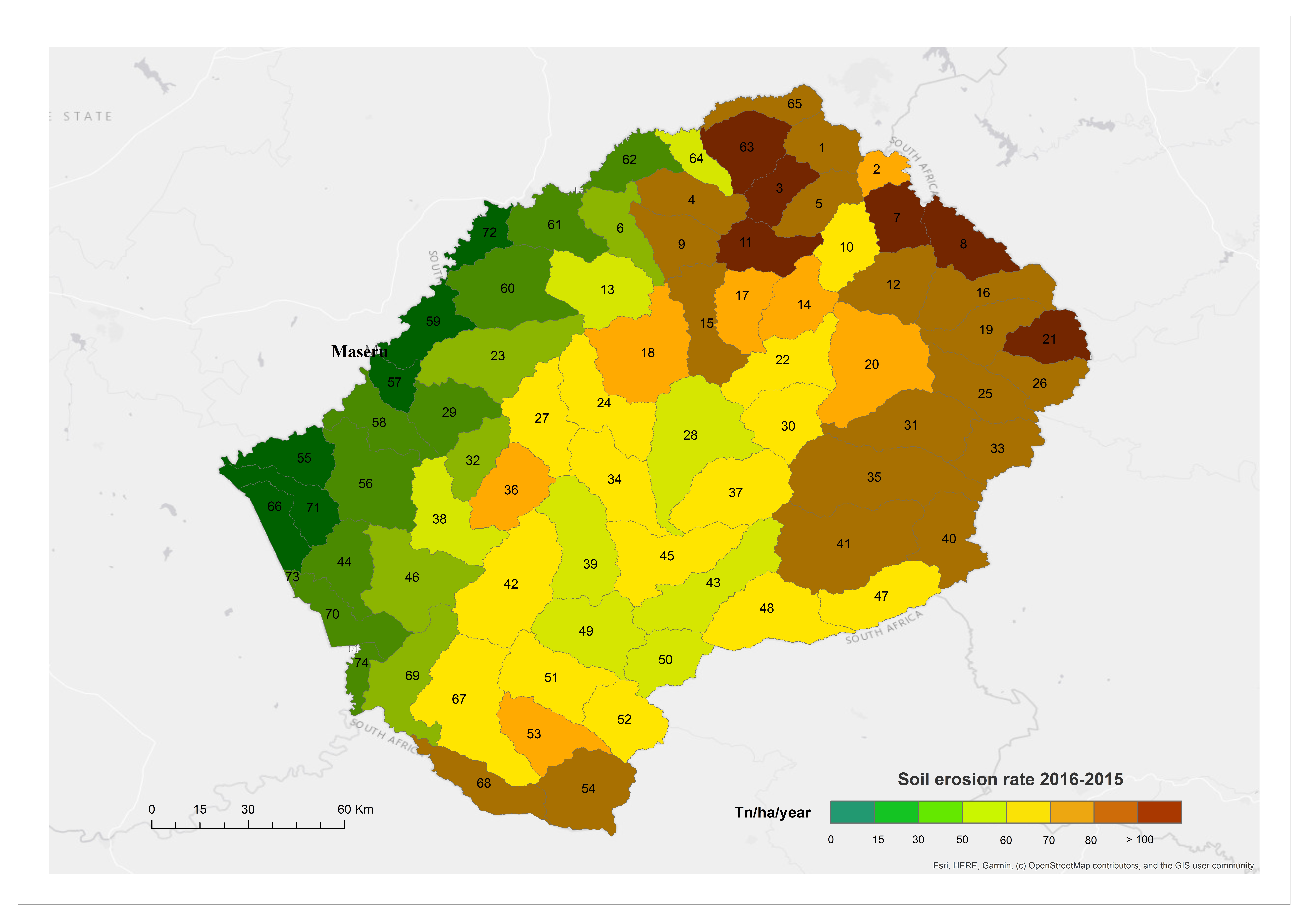
Among the world’s regions suffering from land degradation, the most affected continent is Asia with 79% of the global rural population residing in degrading agricultural areas. Tajikistan and Kyrgyzstan in Central Asia are both severely affected by soil erosion. EO-based products can provide evidence related to soil erosion that could be used to prioritise sites for landscape restoration investments.
-
Building the case for climate resilience investment (Kyrgyzstan and Tajikistan)
Enhancing the resilience of smallholder producers to climate risks will be achieved by mainstreaming sustainable participatory natural resource management into all agricultural production systems and diversifying income sources. EO data can be used to help build the rationale for climate resilience investments and improve access to climate finance.
-
Assessing soil organic carbon stock (Kyrgyzstan and Tajikistan)
Rangeland ecosystems cover a large portion of Earths’ surface and contain substantial amounts of soil organic carbon. Land degradation is indeed recognized as a main environmental problem that adversely depletes soil organic carbon stocks, which in turn directly affects soils, their fertility, productivity, and overall quality. EO can provide quantitative information on pasturelands degradation by assessing the health of palatable species in rangelands over the last decades.

Map of soil loss due to water erosion aggregated by Lesotho's sub-catchments. Source: GMV


