
The European Space Agency’s (ESA) Earth Observation for Sustainable Development Climate Resilience (EO4SD CR) has released a new brochure providing an overview of its work supporting Monrovia’s Integrated Development Project (MIDP). MIDP has applied EO data to support its efforts to identify pragmatic, spatially integrated and location specific integrations that contribute to service delivery, improved welfare, and the creation of jobs throughout the local area and in the rest of Liberia.
Click here to download the brochure.
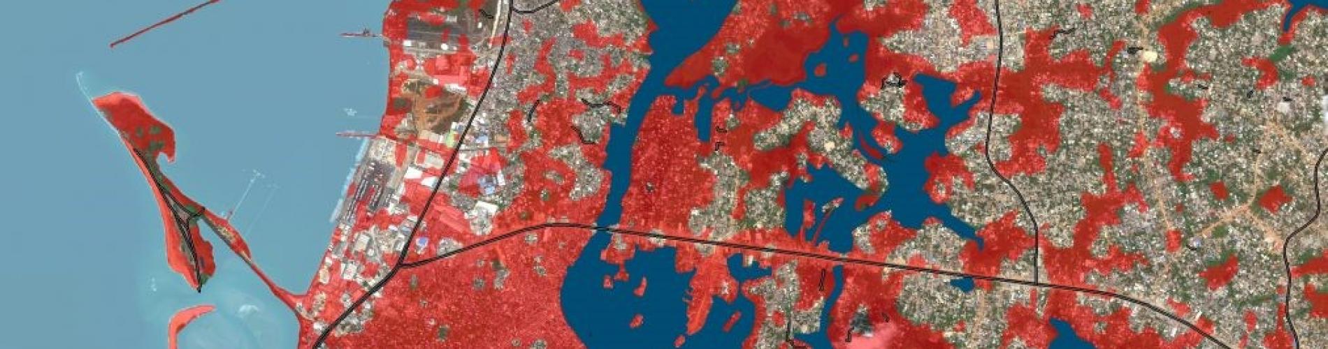
The brochure describes how the EO4SD CR cluster supported MIDP in combining high resolution EO data with projections relating to shoreline erosion and sea level rise in order to create a hot spot analysis of flooding in Monrovia. This flood risk model helps to identify the more effective actions to manage flood risk, develop adaptation plans, and consider where to natural flood management could be most effective. Additionally, by overlaying high-resolution satellite imagery, critical infrastructure and settlements can be identified, and their flood risk assessed. This enables decision makers to make informed decisions about the suitability of developing sites providing crucial infrastructure services, such as transport hubs and hospitals.
The EO4SD CR cluster provides insight about the potential of Earth Observation (EO) data to support climate-resilient decision making at the regional and national scale. In collaboration with several International Financial Institutions, the EO4SD CR cluster has developed EO-based screening and risk management products that can be integrated into different platforms and project cycles.
Other summaries of EO4SD CR projects can be found here, as well as a webinar series outlining how different EO data products have been used and hands-on guided sessions on how to use the different data platforms.
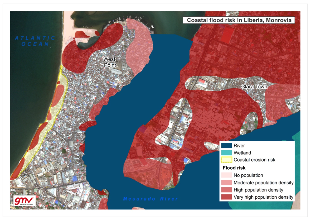
Analysis of flood risk over West Point and Clara Town (Greater Monrovia, Liberia) estimated by the exposure (population) and hazard (potential coastal flooding). Source: GMV